WWII Africa Campaign Map: Base Layer and 3D Printing
The task is simple: Game on a new continent by creating a WWII Africa campaign map in 3D to encompass the whole African theater. It must be worthy of wall space and provide context to any and all game systems that mine the WWII desert sands for the many opportunities it offers a gamer. Why the Africa campaign? For a scratch built campaign map the scope seems more manageable than, say, the D-Day landings and after a couple of years of driving the most powerful armour around Normandy I’m looking forward to a theatre shift and trading in my Panzer IVs for Panzer IIs.

My father’s war medals
My fascination with WWII came naturally. My father, a journeyman electrician at the outbreak of WWII, was denied entrance to the paratroop school he had hoped for and assigned instead to the Royal Artillery keeping searchlights up and running during the blitz in Southampton, and then again in Sicily. Next he joined the Allied advance toward Rome on a motorbike with sidecar, repairing electrical problems in everything from Triumphs to Shermans, from rear HQ to forward observation posts. I hung on every word on the rare occasion he talked about his service in the army. I knew, however, that those days stayed with him. Fifty years later he would still get emotional on Remembrance Day. A rare twitch from a truly stiff upper lip.

The cream jug in question
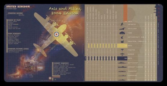
My desire to know more about the defining period of my dad’s life and my interest in gaming meant I was a sucker for Axis and Allies when introduced to it. Teenage friends Ric, Duff, and I replayed WWII in its entirety for afternoons at a time on the dining room table. In turn, those games would translate into discussion around that same table at dinner. I’d ask my dad once again what it was like to hear Churchill speak. My dad admired him greatly and as silent as he was on other aspects of the war dad was always up for reciting, in character, parts of the PM’s speeches. When my mother wasn’t looking her prized Winston milk and cream jugs were pressed into service as a kind of hand puppet.
Ever since, I’ve been trying to recapture that vast sweep, the grand story of the campaign that big-context games had to offer. After a game of Chain of Command, Memoir ’44, War at Sea, or Bolt Action I want it to matter in a larger context.
What’s missing amid the assortment of great WWII games is connection and context. I want every recce mission, tank battle, dogfight, and depth charge to help steer an overall narrative.
There are a lot of capable campaign systems for miniature skirmish games like Chain of Command to provide linked story lines between individual matches. Memoir ’44 has campaign books. War at Sea and Wings of Glory offer linked battles. I want bigger! I want sinking of cargo ships in the Mediterranean to give the Germans less resupply to Tripoli. SAS raids on German airfields should boost British morale and take some wind out from under the Luftwaffe’s wings. I want Monty’s caution and Rommel’s dash to translate into missed opportunities and overextended supply lines. Sacrilege I know, but I want games of Bolt Action and Chain of Command and Flames of War – and every single other WWII game past, present, and future – to shape the final outcome on a really cool looking map.
How to Lay the Foundation of the Map and Why Do it This Way?
It had to be magnetic to allow a versatile set of scoring tracks for everything from Axis airpower to Allied morale. A simple track with magnetic markers allows these items to be understood at a glance and changed easily. Also, the board needs to support magnetic markers for possession of key ports, passes, and cities as well as to show positions of known troop and armour deployment.
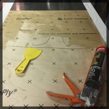
A piece of thin plywood fabricated not to warp was laminated onto thin steel usually used for ductwork. With strong construction adhesive – pay the extra two bucks for the low odour kind – the plywood and steel sheet mated to create a dead flat, rigid base layer with just a touch of flex. It’s also lightweight which will help when I later hang it on a wall. I framed it with oak picture frame moulding to form a barrier when pouring liquid clear resin and, later, give a finished look. Oak can take knocks and not show it unlike softer wood like pine which dents too easily for this project.
What I’d Do Again: Use low odour construction adhesive and sand the base metal so the adhesive and the primer coat has some ‘tooth’ to grip. Use duct work metal. It’s galvanized so it won’t rust, easy to cut with nippers, and perfectly flat so your base layer has no bumps or slope. Rare earth magnets stick to it like glue even through the surface features added later.
What I’d Do Better: Take more time framing and buy the right size moulding instead of cutting what I bought down to size. The less cutting the better the fit later. And you want a good fit when you’re pouring liquid resin and need a perfect barrier around the outside. Don’t ask me how I know that.
It had to be hex based to allow easy tracking of movement and an overall attractive pattern. I looked everywhere for hexes of the size, thickness, and quantity that I needed. I ended up at Orleans Hobbies where the very helpful Ron put his AutoCAD skills and 3D printer to work on my behalf. In about a week I had the masters to later cast the hundreds of hexes I’d eventually need.
Hexes in hand, I shamelessly used the Eurofront map and Games Workshop’s Mighty Empires as templates to give me ideas for how to lay things out and how many hexes I’d need. I have more than a passing interest in geography so I found this rare opportunity to do cartography from scratch interesting, and I realized I’d need A LOT of hexes. Over 700 to be more precise. The hex mass production method can be found in the next post.
What I’d Do Again: Get the hexes 3D printed unless you’re blessed (I’m not!) with a steady hand and sculpting skills. Get a lot of hexes in different numbers (singles, sets of 4, 6, 8, 12) printed. Use the same 3 cm hex to make the map about 4 feet wide by 2 feet high.
What I’d Do Better: I would just go ahead and get all the hexes I needed 3D printed. It would have worked out about the same price with a lot less work and with better precision in the finished layout. Also, get the hexes printed with greater density. Because they are a lattice of lines they are permeable to liquid. I had to work really hard to seal them before putting things like latex rubber and liquid resin on them. All the resin casting I ended up doing, in retrospect, could have been avoided completely.
In the next post we’ll look at the resin casting process to make the land and ocean hexes, mountain tiles, and small items like port and convoy markers. We’ll assemble the map and work toward getting ready to pour Envirotex Lite to make the Mediterranean look like real water.
Other posts in the Africa Campaign Map series are:
WWII Africa Campaign Map: Resin Casting and Prep for Envirotex Light
WWII Africa Campaign Map Part 3: Envirotex Water, Airbrush, Graphics


Pingback: WWII Africa Campaign Map: Resin Casting and Prep for Envirotex Light | On Sean's Table
Pingback: Game On a New Continent! | On Sean's Table
Pingback: Publication in Wargames, Soldiers, & Strategy Magazine, #94 | On Sean's Table
Pingback: Desert Terrain: Palm Trees Tutorial | On Sean's Table
Pingback: Desert Terrain: Village Well Tutorial | On Sean's Table
Pingback: Battlegames Guest Post: Bricking It | On Sean's Table
Pingback: Masking camo on a PSC 15mm StuG | On Sean's Table
Pingback: 3D Printing Wargame Fantasies | On Sean's Table